
Make a donation
Sugar Mountain topographic map
Click on the map to display elevation.
Make a donation
About this map
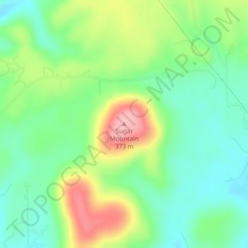
Name: Sugar Mountain topographic map, elevation, terrain.
Average elevation: 289 m
Minimum elevation: 243 m
Maximum elevation: 369 m
Make a donation
Other topographic maps
Click on a map to view its topography, its elevation and its terrain.
Tenkiller Ferry Lake
United States > Oklahoma > Cherokee County > Paradise Hill
The hydroelectric power station is remotely controlled from the control center at Fort Gibson Lake. Two generators, each rated for 17 megawatts, provide a total capacity of 34 megawatts (MWe). The facility can handle 40 MWe for a short period of time. However, the amount of power that can actually be generated…
Average elevation: 258 m
Sparrowhawk
United States > Oklahoma > Cherokee County
Sparrowhawk is located in eastern Cherokee County along a large bend on the west side of the Illinois River. Much of the community is on top of Sparrow Hawk Mountain, a 1,080-foot-elevation (330 m) plateau that rises 360 feet (110 m) above the river. The CDP is bordered on the west by Oklahoma State Highway…
Average elevation: 298 m
Make a donation