
Thank you for supporting this site ❤️
Make a donation
Make a donation
Tagudin topographic map
Click on the map to display elevation.
Thank you for supporting this site ❤️
Make a donation
Make a donation
About this map
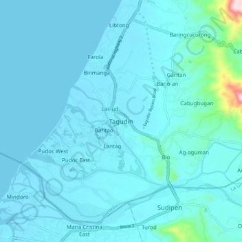
Name: Tagudin topographic map, elevation, terrain.
Location: Tagudin, Ilocos Sur, Ilocos Region, 2714, Philippines (16.89457 120.40502 16.97457 120.48502)
Average elevation: 24 m
Minimum elevation: -2 m
Maximum elevation: 331 m
Thank you for supporting this site ❤️
Make a donation
Make a donation
Other topographic maps
Click on a map to view its topography, its elevation and its terrain.