
Xinfeng topographic map
Interactive map
Click on the map to display elevation.
About this map
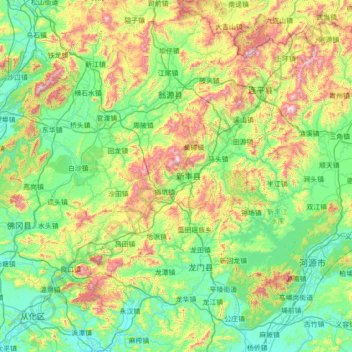
Name: Xinfeng topographic map, elevation, terrain.
Location: Xinfeng, Shaoguan City, Guangdong, PRC (23.41772 113.51302 24.69772 114.79302)
Average elevation: 310 m
Minimum elevation: 9 m
Maximum elevation: 1,324 m
Other topographic maps
Click on a map to view its topography, its elevation and its terrain.
Yangdong District
Yangdong District, Yangjiang City, Guangdong, PRC
Average elevation: 55 m