
Thank you for supporting this site ❤️
Make a donation
Make a donation
San Antonio topographic map
Click on the map to display elevation.
Thank you for supporting this site ❤️
Make a donation
Make a donation
About this map
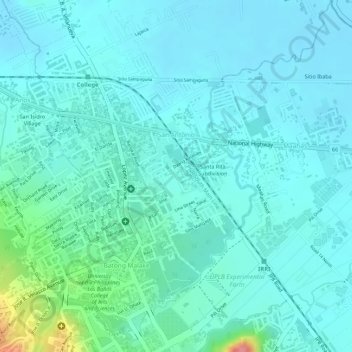
Name: San Antonio topographic map, elevation, terrain.
Location: San Antonio, Los Baños, Laguna, Calabarzon, Philippines (14.16670 121.24098 14.18178 121.25359)
Average elevation: 21 m
Minimum elevation: 4 m
Maximum elevation: 101 m
Thank you for supporting this site ❤️
Make a donation
Make a donation
Other topographic maps
Click on a map to view its topography, its elevation and its terrain.