
Thank you for supporting this site ❤️
Make a donation
Make a donation
Devrekani topographic map
Click on the map to display elevation.
Thank you for supporting this site ❤️
Make a donation
Make a donation
Devrekani
Devrekani is a town and district of the Kastamonu Province in the Black Sea region of Turkey. According to the 2000 census, population of the district is 15,855 of which 6,174 live in the town of Devrekani. The district covers an area of 599 km2 (231 sq mi), and the town lies at an elevation of 1,116 m (3,661 ft).
Thank you for supporting this site ❤️
Make a donation
Make a donation
About this map
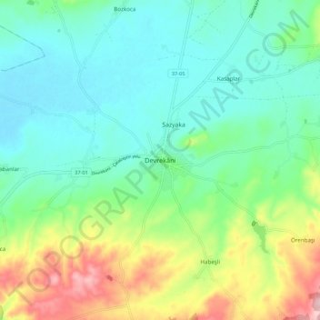
Name: Devrekani topographic map, elevation, terrain.
Location: Devrekani, Kastamonu, Black Sea Region, Turkey (41.56256 33.79709 41.64256 33.87709)
Average elevation: 1,108 m
Minimum elevation: 1,044 m
Maximum elevation: 1,266 m
Thank you for supporting this site ❤️
Make a donation
Make a donation