
Thank you for supporting this site ❤️
Make a donation
Make a donation
Spenge topographic map
Click on the map to display elevation.
Thank you for supporting this site ❤️
Make a donation
Make a donation
About this map
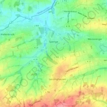
Name: Spenge topographic map, elevation, terrain.
Location: Spenge, Kreis Herford, North Rhine-Westphalia, 32139, Germany (52.10713 8.43792 52.16399 8.50492)
Average elevation: 108 m
Minimum elevation: 72 m
Maximum elevation: 165 m
Thank you for supporting this site ❤️
Make a donation
Make a donation