
Thank you for supporting this site ❤️
Make a donation
Make a donation
Grant Grove topographic map
Click on the map to display elevation.
Thank you for supporting this site ❤️
Make a donation
Make a donation
About this map
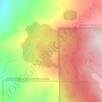
Name: Grant Grove topographic map, elevation, terrain.
Location: Grant Grove, Fresno County, California, United States (36.74200 -118.99524 36.75749 -118.96878)
Average elevation: 1,779 m
Minimum elevation: 1,433 m
Maximum elevation: 2,032 m
Thank you for supporting this site ❤️
Make a donation
Make a donation
Other topographic maps
Click on a map to view its topography, its elevation and its terrain.