
Tiniroto topographic map
Click on the map to display elevation.
About this map
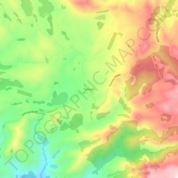
Name: Tiniroto topographic map, elevation, terrain.
Location: Tiniroto, Gisborne, New Zealand (-38.79347 177.54704 -38.75347 177.58704)
Average elevation: 328 m
Minimum elevation: 127 m
Maximum elevation: 544 m
Gisborne trails, hiking, mountain biking, running and outdoor activities
Other topographic maps
Click on a map to view its topography, its elevation and its terrain.