
Kotoura topographic map
Interactive map
Click on the map to display elevation.
About this map
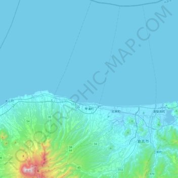
Name: Kotoura topographic map, elevation, terrain.
Location: Kotoura, Tohaku County, Tottori Prefecture, Japan (35.35510 133.55894 35.71198 133.76781)
Average elevation: 106 m
Minimum elevation: -5 m
Maximum elevation: 1,698 m
Other topographic maps
Click on a map to view its topography, its elevation and its terrain.