
Wichita topographic map
Interactive map
Click on the map to display elevation.
About this map
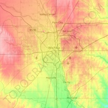
Name: Wichita topographic map, elevation, terrain.
Location: Wichita, Sedgwick County, Kansas, United States (37.48902 -97.73435 37.84020 -97.15300)
Average elevation: 408 m
Minimum elevation: 355 m
Maximum elevation: 459 m
Downtown Wichita is at 37°41′20″N 97°20′10″W / 37.68889°N 97.33611°W / 37.68889; -97.33611 (37.688888, −97.336111), at an elevation of 1,299 feet (396 m). Wichita is in south-central Kansas at the junction of Interstate 35 and U.S. Route 54. Part of the Midwestern United States, it is 157 mi (253 km) north of Oklahoma City, 181 mi (291 km) southwest of Kansas City, and 439 mi (707 km) east-southeast of Denver.