
Thank you for supporting this site ❤️
Make a donation
Make a donation
Fort Smith topographic map
Click on the map to display elevation.
Thank you for supporting this site ❤️
Make a donation
Make a donation
About this map
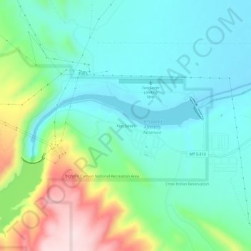
Name: Fort Smith topographic map, elevation, terrain.
Location: Fort Smith, Big Horn County, Montana, 59035, United States (45.29274 -107.95706 45.33274 -107.91706)
Average elevation: 1,059 m
Minimum elevation: 963 m
Maximum elevation: 1,322 m
Thank you for supporting this site ❤️
Make a donation
Make a donation
Other topographic maps
Click on a map to view its topography, its elevation and its terrain.