
東淀川区 topographic map
Interactive map
Click on the map to display elevation.
About this map
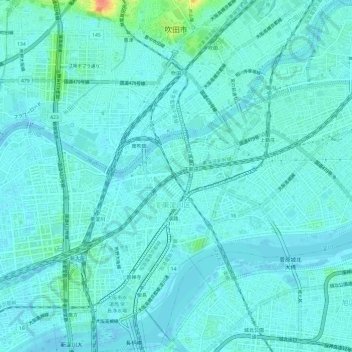
Name: 東淀川区 topographic map, elevation, terrain.
Location: 東淀川区, Ōsaka, Préfecture d'Osaka, Japon (34.71941 135.50203 34.76885 135.56053)
Average elevation: 7 m
Minimum elevation: -3 m
Maximum elevation: 50 m
Other topographic maps
Click on a map to view its topography, its elevation and its terrain.