
Taos topographic map
Interactive map
Click on the map to display elevation.
Taos
The elevation of the town is 6,967 feet (2,124 m). Just north of Taos is Wheeler Peak, at 13,161 feet (4,011 m), the highest point in New Mexico. Taos has a warm-summer humid continental climate (Köppen Dfb), though it borders on a semi-arid climate (BSk) due to the low rainfall. The city is characterized by extreme diurnal variations of temperature. Even when summer days get extremely hot, nights can be pleasantly cool.
About this map
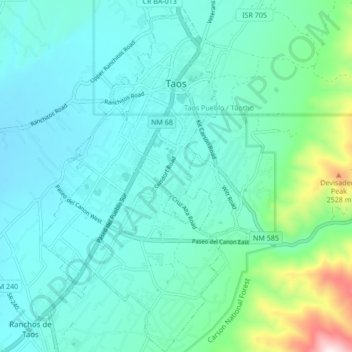
Name: Taos topographic map, elevation, terrain.
Location: Taos, Taos County, New Mexico, United States (36.35496 -105.60605 36.42347 -105.55629)
Average elevation: 2,180 m
Minimum elevation: 2,066 m
Maximum elevation: 2,739 m