
Izara topographic map
Interactive map
Click on the map to display elevation.
About this map
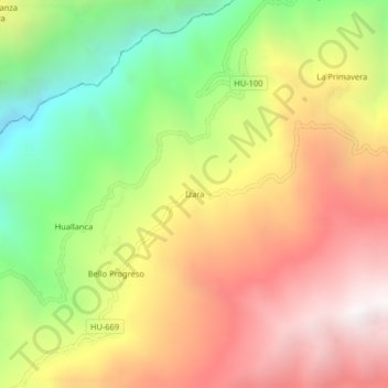
Name: Izara topographic map, elevation, terrain.
Location: Izara, Huacaybamba, Huánuco, Pérou (-9.00404 -76.99761 -8.96404 -76.95761)
Average elevation: 3,439 m
Minimum elevation: 2,520 m
Maximum elevation: 4,311 m