
Lagawa topographic map
Interactive map
Click on the map to display elevation.
About this map
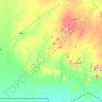
Name: Lagawa topographic map, elevation, terrain.
Location: Lagawa, West Kurdufan, Sudan (10.08195 28.63882 12.47602 29.92184)
Average elevation: 524 m
Minimum elevation: 400 m
Maximum elevation: 1,091 m