
Villetta Di Negro topographic map
Interactive map
Click on the map to display elevation.
About this map
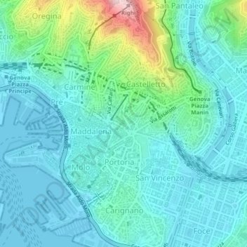
Name: Villetta Di Negro topographic map, elevation, terrain.
Location: Villetta Di Negro, Genoa, Liguria, 16122, Italy (44.41116 8.93694 44.41126 8.93704)
Average elevation: 53 m
Minimum elevation: -3 m
Maximum elevation: 289 m
Other topographic maps
Click on a map to view its topography, its elevation and its terrain.