
Thank you for supporting this site ❤️
Make a donation
Make a donation
Maple Falls topographic map
Click on the map to display elevation.
Thank you for supporting this site ❤️
Make a donation
Make a donation
About this map
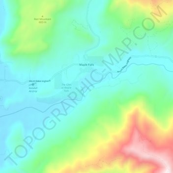
Name: Maple Falls topographic map, elevation, terrain.
Location: Maple Falls, Whatcom County, Washington, United States (48.90386 -122.11554 48.93225 -122.07183)
Average elevation: 226 m
Minimum elevation: 133 m
Maximum elevation: 620 m
Thank you for supporting this site ❤️
Make a donation
Make a donation