
Thank you for supporting this site ❤️
Make a donation
Make a donation
Salihli topographic map
Click on the map to display elevation.
Thank you for supporting this site ❤️
Make a donation
Make a donation
Salihli
The city of Salihli, the seat of the district, is located on İzmir-Ankara (E 96) highway and the parallel railway connections. The urban zone is situated on the slopes of Bozdağ mountain chain along the southern alluvial plains of the Gediz River. To the north and northeast of the plain extend two other mountain ranges, respectively those of the mounts Dibek (highest altitude 1120 m) and Üşümüş (highest altitude 1085 m).
Thank you for supporting this site ❤️
Make a donation
Make a donation
About this map
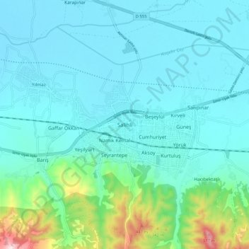
Name: Salihli topographic map, elevation, terrain.
Location: Salihli, Adala, Salihli, Manisa, Aegean Region, 45310, Turkey (38.44606 28.09900 38.52606 28.17900)
Average elevation: 157 m
Minimum elevation: 78 m
Maximum elevation: 580 m
Thank you for supporting this site ❤️
Make a donation
Make a donation