
Thank you for supporting this site ❤️
Make a donation
Make a donation
Boťany topographic map
Click on the map to display elevation.
Thank you for supporting this site ❤️
Make a donation
Make a donation
Boťany
The village lies at an altitude of 103 metres and covers an area of 19.522 km².
Thank you for supporting this site ❤️
Make a donation
Make a donation
About this map
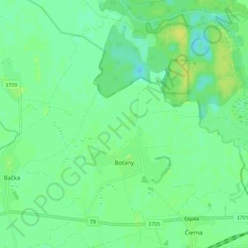
Name: Boťany topographic map, elevation, terrain.
Average elevation: 101 m
Minimum elevation: 94 m
Maximum elevation: 110 m
Thank you for supporting this site ❤️
Make a donation
Make a donation