
Thank you for supporting this site ❤️
Make a donation
Make a donation
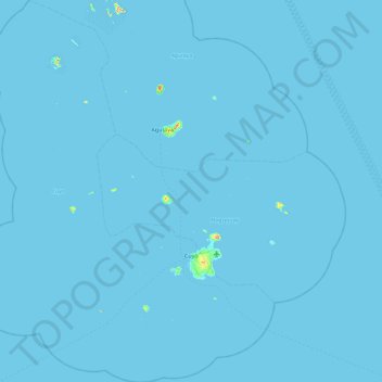
Cuyo topographic map
Click on the map to display elevation.
Thank you for supporting this site ❤️
Make a donation
Make a donation
Cuyo
Cuyo Island is the largest island of the Cuyo Archipelago, about 13 kilometres (8.1 mi) long, 7.5 kilometres (4.7 mi) wide, and with an area of 57 square kilometres (22 sq mi). Mount Bonbon with an elevation of 817 ft (249 m) is the highest mountain in Cuyo island. The Island is under the jurisdiction of the municipalities of Cuyo and Magsaysay. The poblacion of Cuyo is home to a Spanish fort, which shelters a church and a convent in its high stone walls..
Thank you for supporting this site ❤️
Make a donation
Make a donation
About this map
Name: Cuyo topographic map, elevation, terrain.
Location: Cuyo, Palawan, Mimaropa, 5318, Philippines (10.55859 120.47054 11.46030 121.20413)
Average elevation: 0 m
Minimum elevation: -1 m
Maximum elevation: 243 m
Thank you for supporting this site ❤️
Make a donation
Make a donation