
Thank you for supporting this site ❤️
Make a donation
Make a donation
Maratoto Stream topographic map
Click on the map to display elevation.
Thank you for supporting this site ❤️
Make a donation
Make a donation
About this map
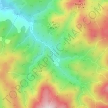
Name: Maratoto Stream topographic map, elevation, terrain.
Location: Maratoto Stream, Hauraki District, Waikato, New Zealand (-37.31620 175.75258 -37.30006 175.76857)
Average elevation: 244 m
Minimum elevation: 61 m
Maximum elevation: 470 m
Hauraki District trails, hiking, mountain biking, running and outdoor activities
Thank you for supporting this site ❤️
Make a donation
Make a donation
Other topographic maps
Click on a map to view its topography, its elevation and its terrain.