
Thank you for supporting this site ❤️
Make a donation
Make a donation
El Agustino topographic map
Click on the map to display elevation.
Thank you for supporting this site ❤️
Make a donation
Make a donation
About this map
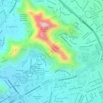
Name: El Agustino topographic map, elevation, terrain.
Location: El Agustino, Lima, 15002, Perú (-12.05653 -76.98813 -12.05643 -76.98803)
Average elevation: 251 m
Minimum elevation: 184 m
Maximum elevation: 481 m
Thank you for supporting this site ❤️
Make a donation
Make a donation