
Lake Cowichan topographic map
Interactive map
Click on the map to display elevation.
About this map
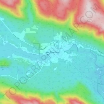
Name: Lake Cowichan topographic map, elevation, terrain.
Average elevation: 378 m
Minimum elevation: 141 m
Maximum elevation: 1,003 m
Other topographic maps
Click on a map to view its topography, its elevation and its terrain.
Kwassin Lake
Canada > Colombie-Britannique > Lake Cowichan
Kwassin Lake, Hudgrove Road, Lake Cowichan, Cowichan Valley Regional District, Colombie-Britannique, V0R 2G0, Canada
Average elevation: 189 m