
Thank you for supporting this site ❤️
Make a donation
Make a donation
Canyon Point topographic map
Click on the map to display elevation.
Thank you for supporting this site ❤️
Make a donation
Make a donation
About this map
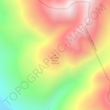
Name: Canyon Point topographic map, elevation, terrain.
Location: Canyon Point, Flathead County, Montana, United States (48.23047 -113.73849 48.23057 -113.73839)
Average elevation: 1,750 m
Minimum elevation: 1,182 m
Maximum elevation: 2,242 m
Thank you for supporting this site ❤️
Make a donation
Make a donation
Other topographic maps
Click on a map to view its topography, its elevation and its terrain.
Thank you for supporting this site ❤️
Make a donation
Make a donation
Thank you for supporting this site ❤️
Make a donation
Make a donation