
Thank you for supporting this site ❤️
Make a donation
Make a donation
Fort Myers topographic map
Click on the map to display elevation.
Thank you for supporting this site ❤️
Make a donation
Make a donation
About this map
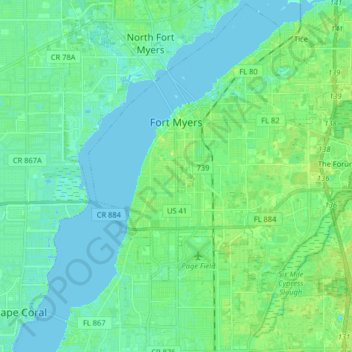
Name: Fort Myers topographic map, elevation, terrain.
Location: Fort Myers, Lee County, Florida, United States (26.54764 -81.91261 26.68918 -81.75114)
Average elevation: 5 m
Minimum elevation: -1 m
Maximum elevation: 13 m
Thank you for supporting this site ❤️
Make a donation
Make a donation
Other topographic maps
Click on a map to view its topography, its elevation and its terrain.