
Thank you for supporting this site ❤️
Make a donation
Make a donation
Flint topographic map
Click on the map to display elevation.
Thank you for supporting this site ❤️
Make a donation
Make a donation
About this map
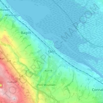
Name: Flint topographic map, elevation, terrain.
Location: Flint, Flintshire, Wales, CH6 5AJ, United Kingdom (53.20928 -3.17453 53.28928 -3.09453)
Average elevation: 58 m
Minimum elevation: -1 m
Maximum elevation: 303 m
Thank you for supporting this site ❤️
Make a donation
Make a donation