
Thank you for supporting this site ❤️
Make a donation
Make a donation
Manambulan topographic map
Click on the map to display elevation.
Thank you for supporting this site ❤️
Make a donation
Make a donation
About this map
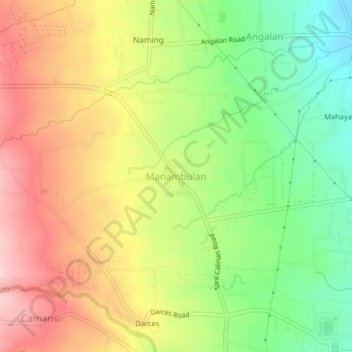
Name: Manambulan topographic map, elevation, terrain.
Location: Manambulan, Davao City, Davao Region, 8022, Philippines (7.08282 125.43347 7.12282 125.47347)
Average elevation: 292 m
Minimum elevation: 172 m
Maximum elevation: 417 m
Thank you for supporting this site ❤️
Make a donation
Make a donation
Other topographic maps
Click on a map to view its topography, its elevation and its terrain.
Thank you for supporting this site ❤️
Make a donation
Make a donation
Thank you for supporting this site ❤️
Make a donation
Make a donation
Thank you for supporting this site ❤️
Make a donation
Make a donation
Thank you for supporting this site ❤️
Make a donation
Make a donation
Thank you for supporting this site ❤️
Make a donation
Make a donation