
Make a donation
City of Rome topographic map
Click on the map to display elevation.
Make a donation
City of Rome
The critical east/west American trade route through the frontier was improved by construction of the Erie Canal. On July 4, 1817, construction on the canal began in Rome. The Erie Canal reaches a summit in Rome, attaining an elevation of 420 feet. The first phase was completed in 1825, connecting the Hudson River by waterway to the Great Lakes. It resulted in an increase in trade and traffic between communities around the Great Lakes and New York City, stimulating development all along the route.
Make a donation
About this map
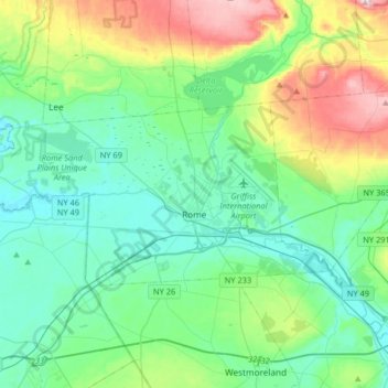
Name: City of Rome topographic map, elevation, terrain.
Location: City of Rome, Oneida County, New York, United States (43.16906 -75.66687 43.28162 -75.34077)
Average elevation: 190 m
Minimum elevation: 115 m
Maximum elevation: 422 m
Make a donation