
Thank you for supporting this site ❤️
Make a donation
Make a donation
Vaires topographic map
Click on the map to display elevation.
Thank you for supporting this site ❤️
Make a donation
Make a donation
About this map
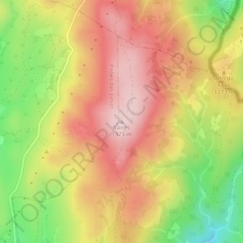
Name: Vaires topographic map, elevation, terrain.
Location: Vaires, Montalegre, Vila Real, 5470-370, Portugal (41.85333 -7.90551 41.85343 -7.90541)
Average elevation: 1,244 m
Minimum elevation: 1,078 m
Maximum elevation: 1,370 m
Thank you for supporting this site ❤️
Make a donation
Make a donation
Other topographic maps
Click on a map to view its topography, its elevation and its terrain.