
Thank you for supporting this site ❤️
Make a donation
Make a donation
North Cove topographic map
Click on the map to display elevation.
Thank you for supporting this site ❤️
Make a donation
Make a donation
About this map
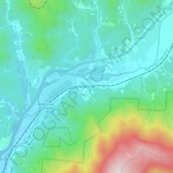
Name: North Cove topographic map, elevation, terrain.
Location: North Cove, McDowell County, North Carolina, United States (35.81596 -82.00900 35.85596 -81.96900)
Average elevation: 564 m
Minimum elevation: 430 m
Maximum elevation: 978 m
Thank you for supporting this site ❤️
Make a donation
Make a donation
Other topographic maps
Click on a map to view its topography, its elevation and its terrain.