
Thank you for supporting this site ❤️
Make a donation
Make a donation
Tapaz topographic map
Click on the map to display elevation.
Thank you for supporting this site ❤️
Make a donation
Make a donation
About this map
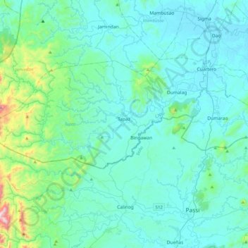
Name: Tapaz topographic map, elevation, terrain.
Location: Tapaz, Capiz, Western Visayas, Philippines (11.15332 122.19902 11.35428 122.59937)
Average elevation: 141 m
Minimum elevation: 7 m
Maximum elevation: 1,147 m
Thank you for supporting this site ❤️
Make a donation
Make a donation
Other topographic maps
Click on a map to view its topography, its elevation and its terrain.