
Thank you for supporting this site ❤️
Make a donation
Make a donation
Cosby topographic map
Click on the map to display elevation.
Thank you for supporting this site ❤️
Make a donation
Make a donation
About this map
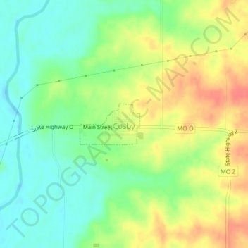
Name: Cosby topographic map, elevation, terrain.
Location: Cosby, Andrew County, Missouri, United States (39.86209 -94.68455 39.86658 -94.67605)
Average elevation: 284 m
Minimum elevation: 260 m
Maximum elevation: 314 m
Thank you for supporting this site ❤️
Make a donation
Make a donation
Other topographic maps
Click on a map to view its topography, its elevation and its terrain.