
Hamouro topographic map
Interactive map
Click on the map to display elevation.
About this map
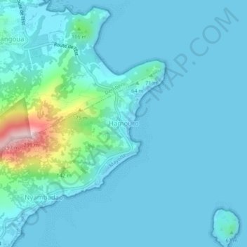
Name: Hamouro topographic map, elevation, terrain.
Location: Hamouro, Bandrélé, Mayotte, 97660, France (-12.90128 45.19499 -12.86128 45.23499)
Average elevation: 32 m
Minimum elevation: 0 m
Maximum elevation: 286 m
Other topographic maps
Click on a map to view its topography, its elevation and its terrain.