
Make a donation
Caribou topographic map
Click on the map to display elevation.
Make a donation
Caribou
Caribou is located in the geographical center of Aroostook County, at an elevation of 449 feet (137 m) above sea level. The county is readily accessible by two major highways; Interstate 95 from the south and the Trans-Canada Highway (New Brunswick Route 2) from the north and east. In sparsely populated Aroostook County, Caribou is at the hub of spokes serving the area via U.S. 1 and Maine State routes 89, 161, 164, 205 and 228. In 2013, a bypass was completed just outside the urban limits.
Make a donation
About this map
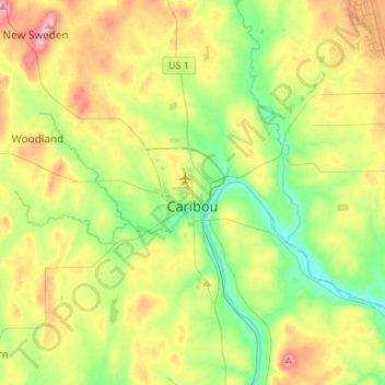
Name: Caribou topographic map, elevation, terrain.
Location: Caribou, Aroostook County, Maine, 04736, United States (46.77555 -68.06288 46.95790 -67.91911)
Average elevation: 181 m
Minimum elevation: 107 m
Maximum elevation: 304 m
Make a donation