
Thank you for supporting this site ❤️
Make a donation
Make a donation
Meme topographic map
Click on the map to display elevation.
Thank you for supporting this site ❤️
Make a donation
Make a donation
About this map
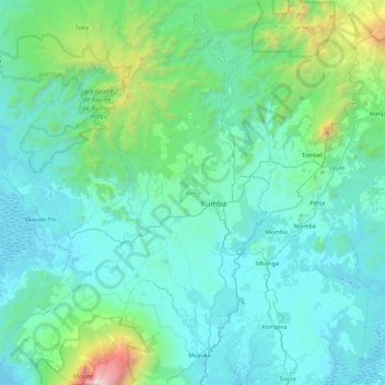
Name: Meme topographic map, elevation, terrain.
Location: Meme, Southwest, Cameroon (4.21557 8.96464 5.10753 9.56877)
Average elevation: 420 m
Minimum elevation: 0 m
Maximum elevation: 4,020 m
Thank you for supporting this site ❤️
Make a donation
Make a donation
Other topographic maps
Click on a map to view its topography, its elevation and its terrain.