Methven topographic map
Interactive map
Click on the map to display elevation.
About this map
![Methven topographic map, elevation, terrain](/pub/maps/node/6sz4/316dm214/thumbnail.jpg)
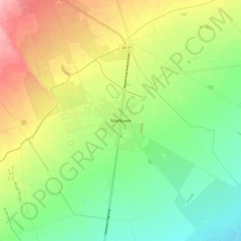
Name: Methven topographic map, elevation, terrain.
Location: Methven, Ashburton District, Canterbury, 7730, New Zealand (-43.67243 171.60726 -43.59243 171.68726)
Average elevation: 322 m
Minimum elevation: 270 m
Maximum elevation: 396 m
Methven (Māori: Piwakawaka) is a small town in the Canterbury region of the South Island of New Zealand. It is located near the western edge of the Canterbury Plains, 35 kilometres north of Ashburton and 95 kilometres west of Christchurch, and at an elevation of 320 m. The town is a service centre for agriculture in the surrounding area, and is a base for skiing at the nearby Mount Hutt skifield. The town slogan is "Amazing Space".
Other topographic maps
Click on a map to view its topography, its elevation and its terrain.
![Ashburton topographic map, elevation, terrain](/pub/maps/node/34z4/75t76mt/icon.jpg)
Ashburton
New Zealand > Canterbury > Ashburton District
Ashburton, Ashburton District, Canterbury, 7700, New Zealand
Average elevation: 99 m
![Lake Hood topographic map, elevation, terrain](/pub/maps/node/khtf/1xp9v4tf/icon.jpg)
Lake Hood
New Zealand > Canterbury > Ashburton District
Lake Hood, Ashburton District, Canterbury, New Zealand
Average elevation: 64 m
![Rakaia topographic map, elevation, terrain](/pub/maps/node/z75k/b4rfl18/icon.jpg)
Rakaia
New Zealand > Canterbury > Ashburton District
Rakaia, Ashburton District, Canterbury, 7710, New Zealand
Average elevation: 105 m
![Ōtūroto / Lake Heron topographic map, elevation, terrain](/pub/maps/relation/39rr/fm21m2/icon.jpg)
Ōtūroto / Lake Heron
New Zealand > Canterbury > Ashburton District
Ōtūroto / Lake Heron, Ashburton District, Canterbury, New Zealand
Average elevation: 750 m
![Totara Peak topographic map, elevation, terrain](/pub/maps/node/9mzs/ckxwcc57/icon.jpg)
Totara Peak
New Zealand > Canterbury > Ashburton District
Totara Peak, Ashburton District, Canterbury, New Zealand
Average elevation: 1,645 m
![Rakaia Gorge lookout topographic map, elevation, terrain](/pub/maps/node/kls8/hg53jrnx/icon.jpg)
Rakaia Gorge lookout
New Zealand > Canterbury > Ashburton District
Rakaia Gorge lookout, Arundel Rakaia Gorge Road, Ashburton District, Canterbury, New Zealand
Average elevation: 358 m
![Dromore topographic map, elevation, terrain](/pub/maps/node/qjtj/b7w499m/icon.jpg)
Dromore
New Zealand > Canterbury > Ashburton District
Dromore, Ashburton District, Canterbury, 7772, New Zealand
Average elevation: 123 m
![Hackthorne topographic map, elevation, terrain](/pub/maps/node/xh57/mjfg2ftj/icon.jpg)
Hackthorne
New Zealand > Canterbury > Ashburton District
Hackthorne, Ashburton District, Canterbury, New Zealand
Average elevation: 199 m
![Mayfield topographic map, elevation, terrain](/pub/maps/node/72tf/3n49jvgt/icon.jpg)
Mayfield
New Zealand > Canterbury > Ashburton District
Mayfield, Ashburton District, Canterbury, 7778, New Zealand
Average elevation: 266 m
![Ashburton Lakes topographic map, elevation, terrain](/pub/maps/node/h5cz/lmzppr51/icon.jpg)
Ashburton Lakes
New Zealand > Canterbury > Ashburton District
Ashburton Lakes, Ashburton District, Canterbury, New Zealand
Average elevation: 645 m
![Ruapuna topographic map, elevation, terrain](/pub/maps/node/dttf/ll7v65mt/icon.jpg)
Ruapuna
New Zealand > Canterbury > Ashburton District
Ruapuna, Ashburton District, Canterbury, New Zealand
Average elevation: 302 m
![Lake Clearwater topographic map, elevation, terrain](/pub/maps/node/46dn/j11ljrr/icon.jpg)
Lake Clearwater
New Zealand > Canterbury > Ashburton District
Lake Clearwater, Ashburton District, Canterbury, New Zealand
Average elevation: 751 m