
Borghetto d'Arroscia topographic map
Interactive map
Click on the map to display elevation.
About this map
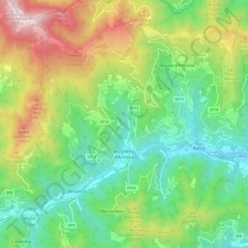
Name: Borghetto d'Arroscia topographic map, elevation, terrain.
Location: Borghetto d'Arroscia, Provincia di Imperia, Liguria, Italy (44.02790 7.94255 44.10653 8.01945)
Average elevation: 582 m
Minimum elevation: 95 m
Maximum elevation: 1,487 m
Other topographic maps
Click on a map to view its topography, its elevation and its terrain.