
Thank you for supporting this site ❤️
Make a donation
Make a donation
Turracher Höhe topographic map
Click on the map to display elevation.
Thank you for supporting this site ❤️
Make a donation
Make a donation
Turracher Höhe
The highest point of the approx. two km long pass summit has an altitude of 1,795 m above sea level south of the Turracher Lake. The lake has a water level of 1,763 m above sea (Adria) level and is connected to the village. The Turracher Höhe, as a "classic" pass summit, is also part of a drainage divide between the Mura valley and the Upper Gurk River, whose source is beneath the Lattersteighöhe at approx. 2,000 m above sea level.
Thank you for supporting this site ❤️
Make a donation
Make a donation
About this map
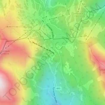
Name: Turracher Höhe topographic map, elevation, terrain.
Average elevation: 1,870 m
Minimum elevation: 1,545 m
Maximum elevation: 2,293 m
Thank you for supporting this site ❤️
Make a donation
Make a donation