
Orle topographic map
Click on the map to display elevation.
About this map
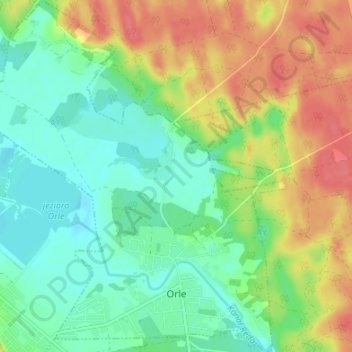
Name: Orle topographic map, elevation, terrain.
Average elevation: 43 m
Minimum elevation: 19 m
Maximum elevation: 77 m
Other topographic maps
Click on a map to view its topography, its elevation and its terrain.
Zbiornik Czymanowo
Poland > Pomeranian Voivodeship > Wejherowo County > Strzebielinek
Average elevation: 94 m