
Thank you for supporting this site ❤️
Make a donation
Make a donation
Shock topographic map
Click on the map to display elevation.
Thank you for supporting this site ❤️
Make a donation
Make a donation
About this map
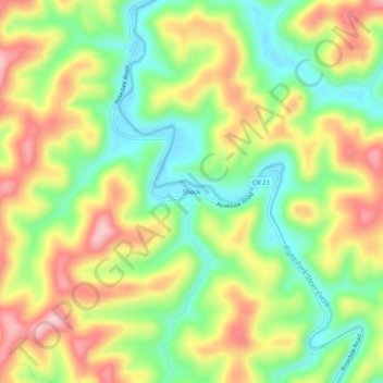
Name: Shock topographic map, elevation, terrain.
Location: Shock, Gilmer County, West Virginia, 26638, United States (38.75843 -80.98650 38.79843 -80.94650)
Average elevation: 307 m
Minimum elevation: 218 m
Maximum elevation: 412 m
Thank you for supporting this site ❤️
Make a donation
Make a donation
Other topographic maps
Click on a map to view its topography, its elevation and its terrain.