
Thank you for supporting this site ❤️
Make a donation
Make a donation
Edinburg topographic map
Click on the map to display elevation.
Thank you for supporting this site ❤️
Make a donation
Make a donation
About this map
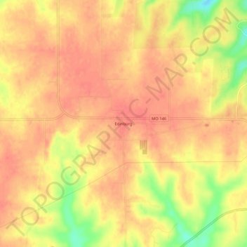
Name: Edinburg topographic map, elevation, terrain.
Location: Edinburg, Grundy County, Missouri, United States (40.06140 -93.71383 40.10140 -93.67383)
Average elevation: 284 m
Minimum elevation: 243 m
Maximum elevation: 298 m
Thank you for supporting this site ❤️
Make a donation
Make a donation
Other topographic maps
Click on a map to view its topography, its elevation and its terrain.