Clark topographic map
Click on the map to display elevation.
Clark
The development is not a flood-prone area with its minimum elevation being at 54 metres (177 ft) above sea level and its planned central park also serves as a flood catchment basin. The Sierra Madre mountain range is located on the development's east while the Zambales mountain range is located on the west, with both geographical features providing New Clark City a natural protection from typhoons. The maximum elevation of New Clark City is at around 800 metres (2,600 ft).
About this map
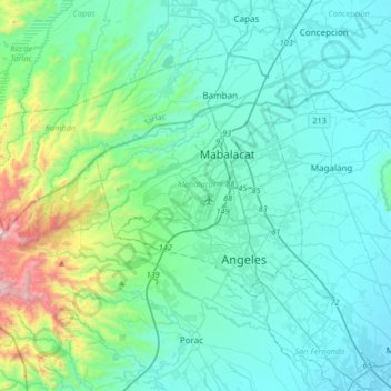
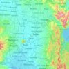
Name: Clark topographic map, elevation, terrain.
Location: Clark, Mabalacat, Pampanga, Central Luzon, 2023, Philippines (15.03094 120.38700 15.35094 120.70700)
Average elevation: 190 m
Minimum elevation: 3 m
Maximum elevation: 1,231 m
Other topographic maps
Click on a map to view its topography, its elevation and its terrain.