
Yangcun topographic map
Interactive map
Click on the map to display elevation.
About this map
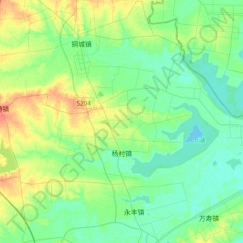
Name: Yangcun topographic map, elevation, terrain.
Location: Yangcun, Tianchang City, Chuzhou City, Anhui, China (32.75717 118.91922 32.87629 119.18912)
Average elevation: 14 m
Minimum elevation: 3 m
Maximum elevation: 39 m