
Thank you for supporting this site ❤️
Make a donation
Make a donation
Redwood Valley topographic map
Click on the map to display elevation.
Thank you for supporting this site ❤️
Make a donation
Make a donation
Redwood Valley
Redwood Valley (formerly Basil) is a census-designated place (CDP) in Mendocino County, California, United States. It is located 9 miles (14 km) north of Ukiah, the county seat, at an elevation of 722 feet (220 m), and comprises the northern portion of the Ukiah Valley. It is about 15 miles (24 km) southeast of Willits. Potter Valley is to the east and Calpella to the south. The ZIP Code is 95470, and the community is in area code 707. The population of the CDP was 1,843 at the 2020 census.
Thank you for supporting this site ❤️
Make a donation
Make a donation
About this map
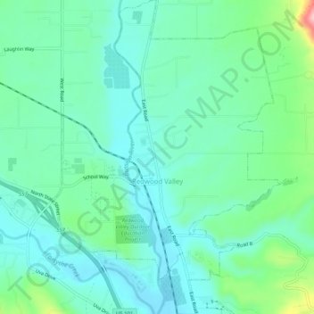
Name: Redwood Valley topographic map, elevation, terrain.
Average elevation: 246 m
Minimum elevation: 205 m
Maximum elevation: 383 m
Thank you for supporting this site ❤️
Make a donation
Make a donation
Other topographic maps
Click on a map to view its topography, its elevation and its terrain.