Wellington topographic map
Interactive map
Click on the map to display elevation.
About this map
![Wellington topographic map, elevation, terrain](/pub/maps/relation/8n14/wz3tf/thumbnail.jpg)
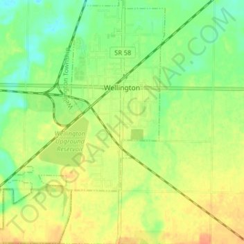
Name: Wellington topographic map, elevation, terrain.
Location: Wellington, Lorain County, Ohio, United States (41.13750 -82.26105 41.18599 -82.20615)
Average elevation: 262 m
Minimum elevation: 244 m
Maximum elevation: 279 m
Other topographic maps
Click on a map to view its topography, its elevation and its terrain.
![Amherst Township topographic map, elevation, terrain](/pub/maps/relation/c5k/954htf/icon.jpg)
Amherst Township
United States > Ohio > Lorain County
Amherst Township, Lorain County, Ohio, United States
Average elevation: 223 m
![Columbia Township topographic map, elevation, terrain](/pub/maps/relation/g1f3/jr58nx/icon.jpg)
Columbia Township
United States > Ohio > Lorain County
Columbia Township, Lorain County, Ohio, 44028, United States
Average elevation: 249 m
![North Ridgeville topographic map, elevation, terrain](/pub/maps/relation/dkkl/7b6s8/icon.jpg)
North Ridgeville
United States > Ohio > Lorain County > North Ridgeville
North Ridgeville, Lorain County, Ohio, 44039, United States
Average elevation: 225 m