
Thank you for supporting this site ❤️
Make a donation
Make a donation
Peel topographic map
Click on the map to display elevation.
Thank you for supporting this site ❤️
Make a donation
Make a donation
About this map
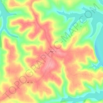
Name: Peel topographic map, elevation, terrain.
Location: Peel, Marion County, Arkansas, 72668, United States (36.41229 -92.78878 36.45229 -92.74878)
Average elevation: 244 m
Minimum elevation: 187 m
Maximum elevation: 292 m
Thank you for supporting this site ❤️
Make a donation
Make a donation