
The Key topographic map
Click on the map to display elevation.
About this map
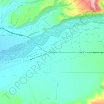
Name: The Key topographic map, elevation, terrain.
Average elevation: 325 m
Minimum elevation: 286 m
Maximum elevation: 485 m
Southland District trails, hiking, mountain biking, running and outdoor activities
Other topographic maps
Click on a map to view its topography, its elevation and its terrain.
Hikuraki / North Mavora Lake
New Zealand > Southland > Southland District > Fiordland Community
Average elevation: 1,071 m