
Cascas topographic map
Interactive map
Click on the map to display elevation.
About this map
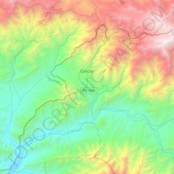
Name: Cascas topographic map, elevation, terrain.
Location: Cascas, Gran Chimú, La Libertad, Pérou (-7.62267 -78.94449 -7.39515 -78.62511)
Average elevation: 1,627 m
Minimum elevation: 342 m
Maximum elevation: 4,297 m
Other topographic maps
Click on a map to view its topography, its elevation and its terrain.
Pampa de Chepate
Pérou > La Libertad > Cascas
Pampa de Chepate, Cascas, Gran Chimú, La Libertad, Pérou
Average elevation: 1,285 m