
Thank you for supporting this site ❤️
Make a donation
Make a donation
Ilasan Ibaba topographic map
Click on the map to display elevation.
Thank you for supporting this site ❤️
Make a donation
Make a donation
About this map
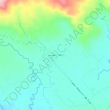
Name: Ilasan Ibaba topographic map, elevation, terrain.
Location: Ilasan Ibaba, Tayabas, Quezon, Calabarzon, 4327, Philippines (14.04351 121.61433 14.08351 121.65433)
Average elevation: 214 m
Minimum elevation: 153 m
Maximum elevation: 409 m
Thank you for supporting this site ❤️
Make a donation
Make a donation