
Thank you for supporting this site ❤️
Make a donation
Make a donation
Rajegwesi topographic map
Click on the map to display elevation.
Thank you for supporting this site ❤️
Make a donation
Make a donation
About this map
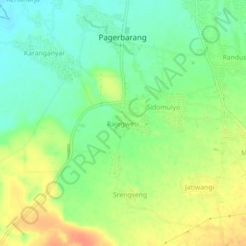
Name: Rajegwesi topographic map, elevation, terrain.
Location: Rajegwesi, Tegal, Central Java, Java, Indonesia (-7.03825 109.03363 -6.99825 109.07363)
Average elevation: 44 m
Minimum elevation: 25 m
Maximum elevation: 67 m
Thank you for supporting this site ❤️
Make a donation
Make a donation